Before Street Numbers, Americans Used Colors and Landmarks to Find Everything

Try explaining to your GPS how to find "the blue house past the old mill, two blocks beyond where the church bell rings loudest." Your device would have a nervous breakdown. But for most of American history, those directions would have gotten you exactly where you needed to go.
Before cities became numbered grids, Americans navigated using a sophisticated system of landmarks, colors, sounds, and social knowledge that made every neighborhood a living map.
When Cities Had Personalities Instead of Addresses
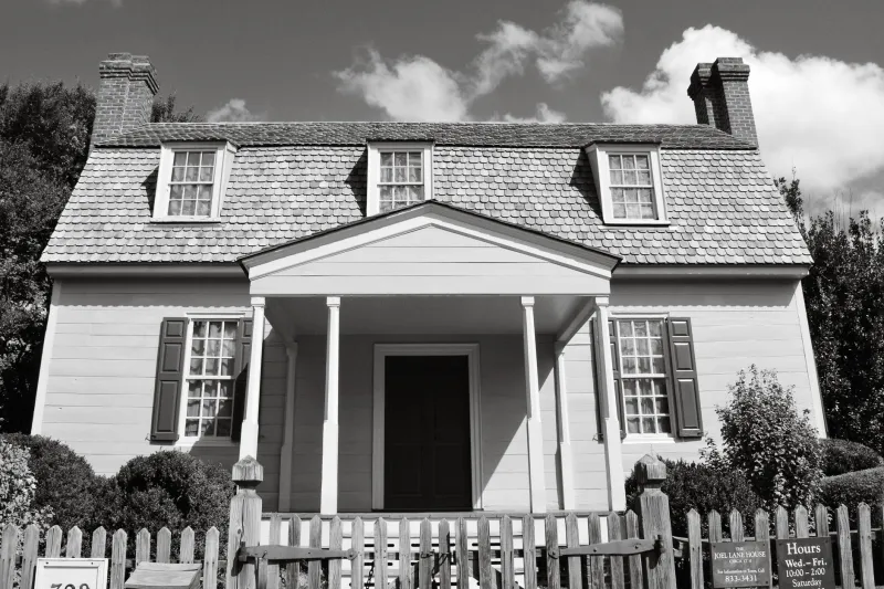
In 1850s Boston, you didn't look for 47 Beacon Street. You looked for "the red brick house with white shutters, three doors down from Dr. Morrison's place, across from where the lamplighter starts his evening rounds."
Every building had visual markers that served as navigation points. Houses were painted distinctive colors specifically to help with identification. Business owners chose bold signage not just for advertising, but as community landmarks. Churches, mills, and public buildings were positioned to serve as anchor points for entire neighborhoods.
This wasn't primitive wayfinding — it was sophisticated spatial organization that worked better than street numbers for people who lived there.
The Sound Map Nobody Remembers
American cities once operated on acoustic navigation that would seem magical today. Church bells didn't just mark time — they marked location. Each church had distinctive bell patterns that residents could identify from miles away. You knew which neighborhood you were in by which bells you could hear.
Factory whistles, train horns, and harbor bells created audio landmarks that helped people navigate even in fog or darkness. Blacksmith hammers, mill wheels, and market vendors created neighborhood soundscapes that were as distinctive as street signs.
Postal workers and delivery drivers learned these audio maps by heart. They could find addresses by listening for the right combination of sounds, even in unfamiliar parts of town.
The Color-Coded Neighborhoods
Many American cities developed informal color systems for navigation. Philadelphia's "Red Brick District" wasn't just a description — it was a navigation zone where buildings were intentionally constructed with matching materials to create visual coherence.
In Charleston, South Carolina, entire blocks were painted in coordinated color schemes that helped residents and visitors orient themselves. "Rainbow Row" wasn't tourist marketing — it was practical city planning that made navigation intuitive.
Some Western towns took this further, with business districts where every building type had its own color code: red for general stores, blue for saloons, green for hotels, yellow for banks.
The Social GPS System
Pre-numbered cities relied heavily on human networks for navigation. Every neighborhood had unofficial "direction givers" — longtime residents who knew everyone and everything, positioned at key street corners or popular gathering spots.
Barbers, postmasters, and shopkeepers served as human GPS systems, maintaining mental maps of who lived where, which buildings were which, and how to explain routes using local knowledge. Asking directions wasn't just getting information — it was plugging into a community database.
Why the System Actually Worked
Modern urban planners are rediscovering why landmark-based navigation was often superior to numbered systems. Human brains are naturally wired to remember spatial relationships, visual markers, and narrative directions better than abstract numbers.
People who navigated by landmarks developed stronger spatial awareness and community knowledge. They knew their neighborhoods intimately — which buildings housed which families, which corners gathered which social groups, which routes were safest at different times of day.
The landmark system also created more resilient navigation. If one reference point disappeared, there were always backup markers. If you couldn't remember the exact house, you could ask any neighbor for clarification.
The Numbered Revolution
Street numbering systems spread across America between 1870 and 1920, driven by postal service efficiency, emergency response needs, and rapid urban growth that outpaced community knowledge systems.
The benefits were obvious: mail delivery became systematic, fire departments could find emergencies faster, and newcomers could navigate without local connections. Cities could grow beyond the scale where everyone knew everyone.
But something was lost in translation. Navigation became anonymous and mechanical. People stopped learning their neighborhoods intimately. Community connections weakened when you didn't need to ask neighbors for directions.
The Holdout Places That Still Confuse GPS
Drive through certain parts of America today, and you'll encounter navigation systems that still baffle modern technology. Some are intentional preservation of local character. Others are just places that never got around to changing.
Parts of rural New England still use "the old Jameson farm" or "where the covered bridge used to be" as primary location markers, even when the farm and bridge disappeared decades ago. Locals understand perfectly. GPS systems have nervous breakdowns.
Some Native American communities maintain traditional spatial organization that doesn't translate to numbered grids. Directions involve seasonal landmarks, family territories, and spiritual geography that makes perfect sense to residents but mystifies mapping algorithms.
Certain historic districts in Charleston, Savannah, and New Orleans preserve pre-numbered navigation systems as cultural heritage. Street numbers exist for official purposes, but locals still give directions using centuries-old landmark references.
What Modern Cities Lost
The shift to numbered navigation systems made cities more efficient but less intimate. People stopped noticing architectural details, neighborhood characters, and local gathering spots that once served as navigation anchors.
Modern residents can live in neighborhoods for years without learning the visual and social landmarks that previous generations knew automatically. We've gained precise location accuracy but lost spatial awareness and community connection.
The GPS Rebellion
Interestingly, smartphone navigation is accidentally recreating some pre-numbered city features. Apps now use visual landmarks ("turn left at the Starbucks"), audio cues, and real-time updates that mirror how Americans once navigated by community knowledge.
Some urban planners are experimenting with "landmark districts" that intentionally use distinctive architecture, public art, and visual markers to create more intuitive navigation systems that don't require constant screen checking.
The next time your GPS fails in an unfamiliar neighborhood, try asking a local for directions. You might discover that America's old landmark-based navigation system is still alive, quietly operating parallel to our numbered grid world — and often working better than the technology that replaced it.