The Self-Taught Mapmaker Who Charted a River So Precisely It Baffled Scientists for Decades
The Map That Shouldn't Have Existed
Cartography in 19th-century America was, by necessity, an improvised science. The instruments were imprecise. The conditions were brutal. Vast regions of the continent were represented on official maps by blank space, dotted lines, or the cartographic equivalent of a shrug — rough sketches based on secondhand reports from trappers and Indigenous guides who had no reason to reduce what they knew to paper.
Against this backdrop, the maps that emerged from the lower Colorado River basin in the 1850s were genuinely anomalous. They were too good. The precision of the river's curves, the accuracy of the elevation data, the detail of the side canyons and tributary washes — all of it was out of step with what the available instruments and methods should have been able to produce. When later surveyors checked the work against their own measurements, they kept finding the same thing: the earlier maps were, in most respects, more accurate than anything that came after them for decades.
The man responsible was Joseph Christmas Ives, a U.S. Army lieutenant who led an expedition up the Colorado River in 1857 and 1858. But the deeper story belongs to the overlooked figures who worked alongside him — particularly the German topographer Heinrich Balduin Möllhausen, and the largely self-taught methods that Ives' team developed on the fly to solve problems that formal surveying training hadn't prepared them for.
Why the Colorado Was So Hard to Map
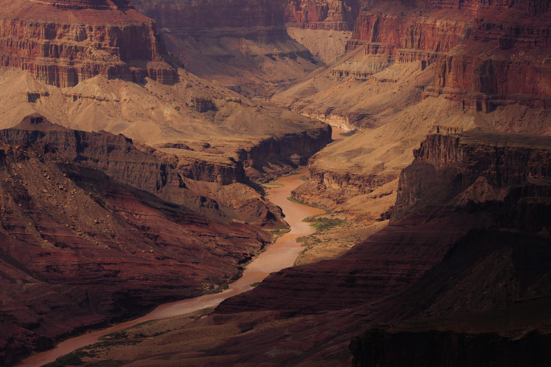
To understand what made this achievement unusual, it helps to understand what the lower and middle Colorado River was actually like to survey in the mid-1800s. The river runs through some of the most geologically complex terrain in North America. Its canyon walls are sheer and disorienting. The light plays tricks. Distances that look manageable from a canyon rim turn out to be vastly different at river level. And the river itself — before the dams that now control it — was wildly variable in depth and current, making navigation by steamboat an unpredictable exercise.
The standard surveying approach of the era relied on triangulation from fixed points, which requires clear sightlines and stable reference positions. The canyon environment made both of those things extraordinarily difficult to establish. Ives' team was essentially working without a reliable playbook.
What they developed instead was a hybrid approach that combined celestial navigation, dead reckoning, direct measurement where possible, and systematic visual observation recorded with a consistency that was unusual for the era. Möllhausen, who had trained as an artist and naturalist rather than a formal surveyor, contributed a visual precision to the topographic sketches that translated into cartographic accuracy in ways that weren't fully appreciated until photographic and aerial comparison became possible in the 20th century.
The River That History Moved Past
The Ives Expedition is remembered — if it's remembered at all — primarily for a remark that turned out to be spectacularly wrong. In his official report, Ives concluded that the Grand Canyon region was "altogether valueless" and that it "shall be forever unvisited and undisturbed." Within a generation, of course, the Grand Canyon had become one of the most visited landscapes in the world.
That quote has followed the expedition's reputation ever since, functioning as a kind of historical punchline that tends to overshadow what the survey actually accomplished. The cartographic work Ives and his team produced was genuinely foundational for later westward expansion and military movement through the region. The maps were used by Union forces during the Civil War to plan logistics through the Southwest. They informed subsequent surveys. They were, in a practical sense, exactly what they were supposed to be: reliable tools for navigating unknown territory.
But the Colorado River itself — particularly the stretch below the Grand Canyon, through what is now the Lake Mead recreation area and into the lower desert — has since become one of the least-visited and least-discussed river systems in the American West despite its central role in the history of the region. The dams changed its character. The interstate highways bypassed its most remote sections. And the Grand Canyon's fame absorbed almost all of the cultural attention that the broader river system might otherwise have received.
What Made the Methods So Ahead of Their Time
The specific innovation that later cartographers found most surprising wasn't any single technique — it was the systematic cross-referencing of multiple measurement approaches that Ives' team employed. Rather than relying on one primary method and using others as rough checks, they treated each measurement type as an independent data stream and looked for convergence. Where methods agreed, they had high confidence. Where they diverged, they flagged the discrepancy and took additional measurements.
This is, essentially, a rudimentary version of the error-correction methodology that became standard in 20th-century surveying and, later, in GPS calibration. The fact that a self-taught team working under field conditions in 1857 arrived at something resembling this approach through practical necessity rather than formal theory is, to put it plainly, remarkable.
A River Worth Rediscovering
The lower Colorado today is a strange, layered place — part reservoir system, part agricultural lifeline, part forgotten wilderness. The stretch that Ives mapped so carefully passes through terrain that most Americans have never seen and couldn't easily describe. The river that was once the most precisely charted waterway in the American West now exists mostly in the background of other stories, a geographic fact rather than a destination.
But the history is there, embedded in those meticulous 19th-century lines on paper. A small group of men working with imperfect tools and no formal training figured out something that took the rest of the field decades to catch up to — and did it on a river that the modern world has mostly forgotten to visit.
That's the kind of story that tends to get lost. Which is, of course, exactly why it's worth finding.